
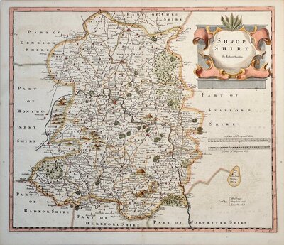
Shropshire Maps
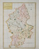
Staffordshire Maps
( Page 1 of 4 )
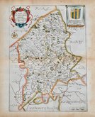
John Speed 1610 [1676]
Richard Blome 1673

Robert Morden 1695
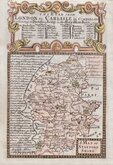
Emanuel Bowen 1720
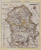
Thomas Read 1744 [c.1769]
Joseph Ellis 1765 [1773]

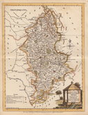
John Cary 1789 [1805]
John Haywood 1791


12x18 cm
FROM "OWEN & BOWEN" ROAD BOOK BRITANNIA DEPICTA
A MAP OF STAFFORD SHIRE
Map set below a decorative cartouche containing the title and details of the road from London to Carlisle.
Road map of the final part of the route from Stilton to Boston and Lincoln verso.
Engraved text descriptions alonside the county map and alongside and below the road map verso.
Engraved by Emanuel Bowen (1693?-1767) and published in the pocket road book Britannia Depicta by Thomas Bowles from 1720 to 1764. The county maps were based on Robert Morden's small series published in The New Description and State of England... from 1701.
Small top margin but still a good example in fine hand colour both sides.
For full description of the road, go to category: Maps > British Isles > RoadMaps > Owen & Bowen.
Quick Links

Worcestershire Maps

Derbyshire Maps
×