
Worcestershire Maps
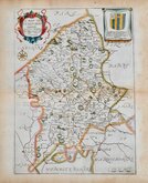
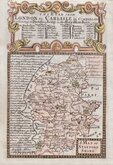
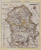
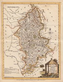
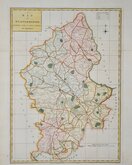
Staffordshire Maps
( Page 1 of 4 )
John Speed 1610 [1676]
Richard Blome 1673

Robert Morden 1695
Emanuel Bowen 1720
Thomas Read 1744 [c.1769]
Joseph Ellis 1765 [1773]

John Cary 1789 [1805]
John Haywood 1791


19x25 cm
EARLY STEEL ENGRAVING.
STAFFORDSHIRE
Published by Archd. Fullarton & Co.
Steel engraving by Robert Scott first published in Bell's New and Comprehensive Gazetteer in 1833. The text for the gazetteer was largely copied from Lewis' Topographical Dictionary of 1831 and in 1839 Lewis obtained an injunction against Bell for plagiarism and the work was withdrawn. Archibald Fullarton, the publisher of Bell's Gazetteer republished the maps with new text in The Parliamentary Gazetteer from 1840 until 1849. Most of the maps were also copied from those in an earlier topographical dictionary, the maps by Sidney Hall prepared for John Gorton's Topographical Dictionary of Great Britain and Ireland published in 1831 as a rival to Lewis' work.
Good hand coloured example of the map of Staffordshire from the 1845 edition with amended publisher's imprint omitting the Glasgow address and engraver's signature erased.
Light toning at centrefold. Large margins.
Quick Links

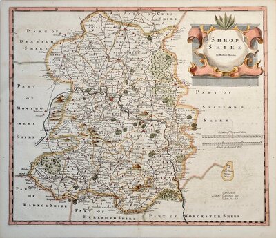
Shropshire Maps

Derbyshire Maps
×