
Worcestershire Maps
Staffordshire Maps
( Page 1 of 4 )
John Speed 1610 [1676]
Richard Blome 1673

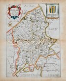
Robert Morden 1695
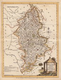
Emanuel Bowen 1720
Thomas Read 1744 [c.1769]
Joseph Ellis 1765 [1773]

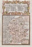
John Cary 1789 [1805]
John Haywood 1791


17x24 cm
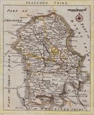
RARE LITHOGRPAHIC EDITION OF PINNOCK'S WOODLOCK MAP
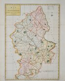
STAFFORD SHIRE
Published by Thomas Johnson in Johnson’s Atlas of England in 1847, this lithographic transfer was taken from the woodblock engraved maps, with white lines on black ground, published in The Guide to Knowledge edited by W. Pinnock… London: W. Edwards 1833-34. The original wood engraving for this Staffordshire map was signed “S.Hall” and is usually attributed to Sidney Hall (1788?-1831) but as the publication of the original work post dates Sidney Hall’s death by two years, the engraver is more likely to have been his wife Selina Hall née Price (1708?-1853) who continued his engraving business after his death and, as a highly skilled engraver whose work is almost indistinguishable from her husband's, was very likely also responsible for some of his output in his later years. Selina signed her work "S.Hall" while Sidney usually signed his maps "Sidy. Hall".
Selena Hall is recorded as an engraver on the 1842 Census, living in Bury Street with a servant. She was buried 23 Nov. 1853 at St. George Bloomsbury. In her will, she left her books, maps etc., to her nephew Edward Weller (1819-1884) who continued the business.
The lithographic transfers for this Johnson edition were taken from an issue by Groombridge Shepherd & Sutton [1838] which included the addition of a decorative banded border with latitude and longitude, though not all counties are known in this “Groombridge” state.
The Johnson atlas did not sell well and examples are rare, a further unchanged issue in 1863 being extremely rare with the atlas known in only a few surviving examples.
Very good example in original hand colour.
Quick Links


Derbyshire Maps
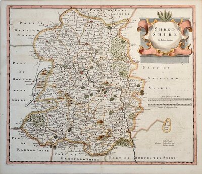
Shropshire Maps
×