
Worcestershire Maps
Staffordshire Maps
( Page 1 of 4 )
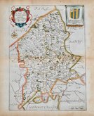
John Speed 1610 [1676]
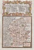
Richard Blome 1673

Robert Morden 1695
Emanuel Bowen 1720
Thomas Read 1744 [c.1769]
Joseph Ellis 1765 [1773]

John Cary 1789 [1805]
John Haywood 1791


18x24 cm
FIRST EDITION IN FINE HAND COLOUR
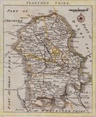
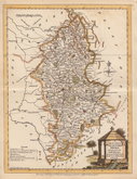
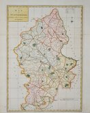
STAFFORDSHIRE
Drawn by R.Creighton | Engraved by J.&C.Walker
DRAWN AND ENGRAVED FRO LEWIS' TOPGRAPHICAL DICTIONARY.
Copper engraving by the firm of J & C Walker from a drawing by Roger Creighton for publication in A Topographical dictionary of England… published by Samuel Lewis and Co. from 1831. The work achieved considerable success and was re-issued many times by Lewis until 1849. During this time the maps were amended and updated to include electoral information and the rapidly expanding railway network, with most counties known in at least six different states.
Good clean example from the first edition of 1831 in fine hand colour.
Quick Links

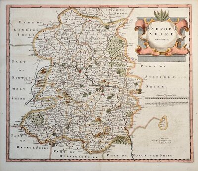
Shropshire Maps

Derbyshire Maps
×