
Maritime
Sea Charts
( Page 1 of 3 )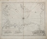
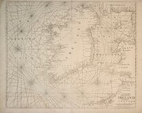
Greenville Collins Irish Sea 1688 [c.1693]
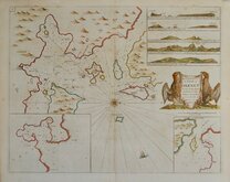
Orkney 1693
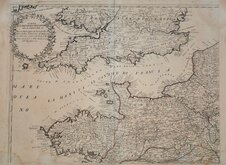
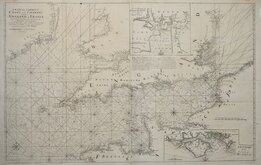
English Channel by Petrini 1715
Bay of Toulon 1739
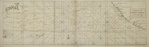
Pacific Ocean by Anson 1748
English Channel 1753
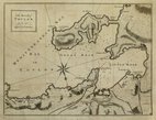
Burnham Flamborough Head Berwick 1755
Mount & Page 1756

Request
Condition Report
PARTE OCCIDENTALE DELLA FRANCIA OUE SI COMPRENDE LA Bassa Bertagna, la Normandia, la Piccardia, il Governo di Maine, Anjou, Orleans, e parte dell' Isola di Francia, con il passo della Manica, e part dell' Inghilterra.
Showing northern France , Southern Britain and the English Channel.
Published by Paolo Petrini c.1715.
Paolo Petrini (1670-1722) was a publisher and map seller in Naples producing maps based on the French maps of Guillaume Sanson and Nicolas de Fer. He is not well recorded and his maps are rare.
Some waterstaining to corners, additional creasing to centrefold, and small bottom margin with some repairs to nicks at centrefold, just affecting the printed edge.
Original outine hand colour.
A rare map.
Quick Links
Map Books

Mediterranean
×