
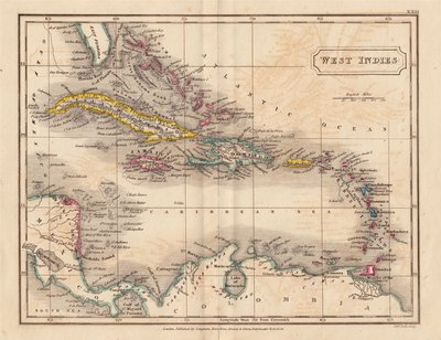
Central America & West Indies
North America
( Page 7 of 8 )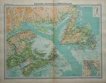
Newfoundland by Bartholomew 1922
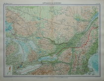
Ontario & Quebec by Bartholomew 1922
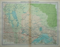
Manitoba & Ontario by Bartholomew 1922
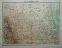
Alberta & Sakatchewan Bartholomew 1922
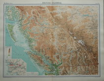
British Columbia by Bartholomew 1922
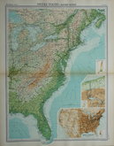
Eastern United States by Bartholomew 1922
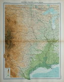
Central United States by Bartholomew 1922
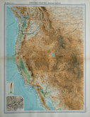
Western United States Bartholomew 1922

£10
John Bartholomew Edinburgh Geographical Institute Ref: 1311.85
Add to
basket
Thanks,Your Product Has Been Added To Basket

55x43 cm
MARITIME PROVINCES & NEWFOUNDLAND
Large double page colour printed lithograph by John Bartholomew & Son Ltd. published in The Times Atlas and Gazetteer of the World by The Edinburgh Geographical Institute 1922.
Showing Newfoundland, part of Quebec, Prince Edward Island, Nova Scotia and New Brunswick. Inset plan of Halifax.
Good clean example with only very slight discolouration at centrefold. (Less pronounced than this image).
Quick Links
World Maps and Charts

South America
×