
South America
North America
( Page 4 of 8 )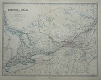
Canada West by Johnston 1879
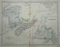
Canada East by Johnston 1879
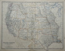
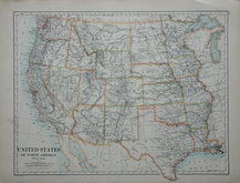
Western United States by Johnston 1879
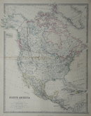
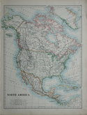
North America by Johnston 1879
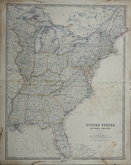
Eastern United States by Johnston 1879
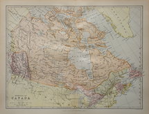
Canada by Bartholomew 1880
North America by Johnston 1884
United States by Johnston 1884

£10
John Bartholomew Edinburgh Geographical Institute Ref: 1311.87
Add to
basket
Thanks,Your Product Has Been Added To Basket

55x43 cm
MANITOBA & NORTH - WEST ONTARIO
Large double page colour printed lithograph by John Bartholomew & Son Ltd. published in The Times Atlas and Gazetteer of the World by The Edinburgh Geographical Institute 1922.
Showing Manitoba, wetern Ontario, Lake Superior, parts of Minnesota and North Dakota.
Good clean example with only very slight discolouration at centrefold (less pronounced than this image).
Quick Links

Central America & West Indies
World Maps and Charts
×