
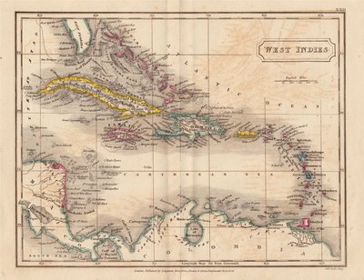
Central America & West Indies
North America
( Page 6 of 8 )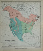
North America. Mammals. 1897
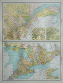
Quebec & Ontario by Bartholomew 1898
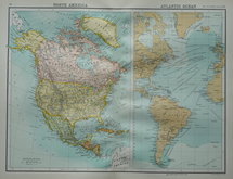
North America & Atlantic Ocean 1898
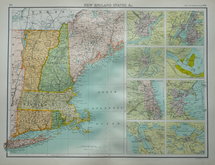
New England States 1898
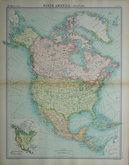
North America by Bartholomew 1922
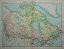
Canada by Bartholomew 1922
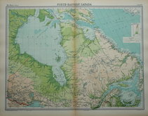
North East Canada by Bartholomew 1922
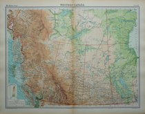
Western Canada by Bartholomew 1922

£15
U S Coast Survey U S Coast Survey Ref: dsm4448
Add to
basket
Thanks,Your Product Has Been Added To Basket
Request
Condition Report
(B No.3) | U.S.Coast Survey | A.D.Bache Superintendent | Showing the progressive changes in | SANDY HOOK | From 1779 to 1853 | Compiled in the office of the U. S. Coast Survey | 1853 ||
SANDY HOOK HEAD || SANDY HOOK | from the Light House to the Ocean House
Showing the changing line of the spit off Middletown, Monmouth County, New Jersey enclosing Lower New York Bay in 10 separate surveys.
Quick Links

South America
World Maps and Charts
×