
Cambridgeshire Maps
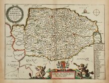
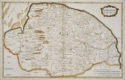
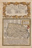
Norfolk Maps
( Page 1 of 3 )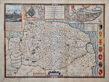
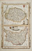
John Speed 1610 [1627]
Richard Blome 1673
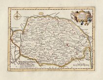
Robert Morden 1695
Emanuel Bowen 1720
Thomas Read 1744 [1753]
Thomas Kitchin 1750 [c.1786]
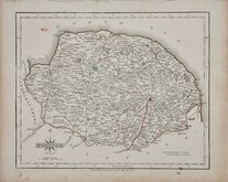
Thomas Conder 1784
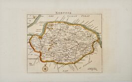
John Cary 1787 [1793]


21x27 cm
CARY'S QUARTO SERIES.
NORFOLK
By JOHN CARY Engraver.
London: Publish'd 1.Jan.1793 by J.Cary Engraver & Map seller Strand.
Copper engraving by John Cary. This series of maps, commonly known as his "quarto" series, were published in Cary's New and Correct English Atlas and were justifiably popular, running to many editions from 1787 until about 1804. Re-engraved plates extended the life of the series from 1808 to 1843 and lithographic transfers from the plates by later publishers continued publication until about 1876 - a life of nearly 90 years.
Final state of the first engraved plate published in Cary's New and Correct English Atlas... London 1793.
Original hand colour but with later red line to the road from Bury St Edmunds to Norwich.
Includes original page of typeset text description of the county with some near contemporary manuscript notes to the page.
Ref. Raymond Frostick Printed Maps of Norfolk [52.2]
Quick Links


Owen & Bowen

England & Wales
×