
England & Wales
Norfolk Maps
( Page 1 of 3 )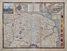
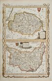
John Speed 1610 [1627]
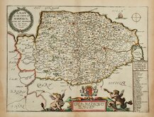
Richard Blome 1673
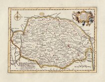
Robert Morden 1695
Emanuel Bowen 1720
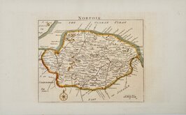
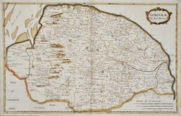
Thomas Read 1744 [1753]
Thomas Kitchin 1750 [c.1786]
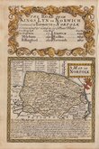
Thomas Conder 1784
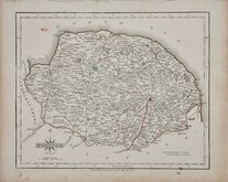
John Cary 1787 [1793]


58x37 cm
FIRST FOLIO MAP OF THE COUNTY TO SHOW ROADS.
NORFOLK By Rob.t Morden.
John Sturt Sculp.
Copper engraving by John Sturt (1657-1730) produced by Robert Morden for publication in Edmund Gibson's translation of William Camden's Britannia first published by Abel Swalle and Awnsham & John Churchill in 1695.
This is the first series of maps to mark longitude in minutes of time (top border) as well as in degrees (bottom border). For most counties longitude is based on the meridian of St. Paul's, London.
The work was republished in 1722, 1730, 1753 and, finally in 1772. The plate was updated for the 1722 edition mostly with changes to place name spellings and was reworked for the 1753 edition due to wear on the plate.
The Norfolk map (and also that of Kent) is larger than the other maps in the series and was often printed on two sheets joined or on separate sheets pasted together, commonly being printed with small margins or loss to side margins.
This example, printed on a single sheet, had small margins, close to the printed line to left, right and lower margins. These have been re-margined with paper from the generous top margin.
A very good impression from the first edition of 1695, without the numerous corrections and alterations to place names etc., of later editions. Folds as issued. Neat later hand colour.
Ref. Frostic Printed Maps of Norfolk [22.1]
Quick Links


Owen & Bowen

Cambridgeshire Maps
×