
Mediterranean
Middle East
( Page 4 of 6 )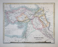
Turkey in Asia by Petermann 1854
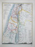
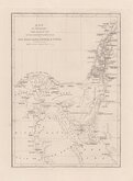
Palestine by Petermann 1854
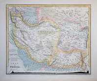
Iran by Petermann 1854
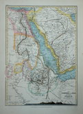
Arabia and Egypt by Petermann 1854
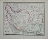
Iran Augustus Peterman 1854 [1860]
Travels of David Roberts 1855
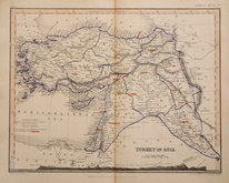
Turkey in Asia by Petermann 1860
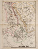
Arabia and Egypt by Petermann 1860


21x28 cm
PALESTINE ANCIENT AND MODERN
Drawn and engraved on steel by John Dower. Published in The Library Atlas of Physical and Political Geography... by WM. S. Orr and Co. London 1854.
Cross sections along bottom border showing West/East sections from the Mediterranean to the Sea of Galilea and to the Dead Sea.
Fine washline hand colour depicting the Tribes of Israel. No centrefold.
Quick Links


Eastern Europe & Turkey
Far East & India
×