
Northamptonshire Maps
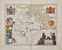
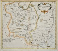
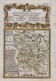
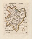
Huntingdonshire Maps
( Page 1 of 5 )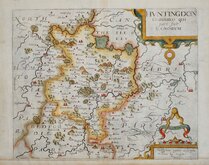
William Kip 1607 [1637]
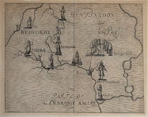
Michael Drayton 1622
Jan Blaeu 1645
John Seller 1694 [c.1784]
Robert Morden 1695
Owen & Bowen 1720
Thomas Read 1744 [1769]
Thomas Kitchin 1763


22x27 cm
FINE EXAMPLE WITH ORIGINAL TEXT PAGE.
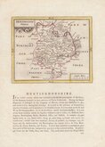
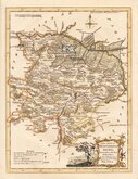
HUNTINGDONSHIRE
By JOHN CARY Engraver.
London: Published by J.Cary Engraver & Map-seller N.o181 Strand. July 1.st 1809
Copper engraving by John Cary. This series of maps, commonly known as his "quarto" series, were published in Cary's New and Correct English Atlas and were justifiably popular, running to many editions from 1787 until about 1804. Re-engraved plates extended the life of the series from 1808 to 1843 and lithographic transfers from the plates by later publishers continued publication until about 1876 - a life of nearly 90 years.
Fine example in original hand colour from the 2nd edition of the re-engraved plate published in 1809. Includes original page of typeset text description of the county.
Quick Links


Cambridgeshire Maps

Bedfordshire Maps
×