
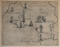
Bedfordshire Maps
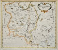
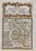
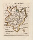
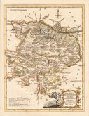
Huntingdonshire Maps
( Page 1 of 5 )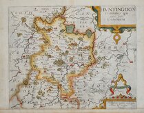
William Kip 1607 [1637]
Michael Drayton 1622
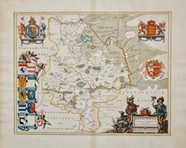
Jan Blaeu 1645
John Seller 1694 [c.1784]
Robert Morden 1695
Owen & Bowen 1720
Thomas Read 1744 [1769]
Thomas Kitchin 1763


18x24 cm
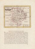
FROM DUGDALE'S CURIOSITIES
HUNTINGDONSHIRE.
Drawn & Engraved by J.Archer, Pentonville, London.
First published in Curiosities of Great Britain, England and Wales Delineated…by Thomas Dugdale by L.Tallis in 1842. The work was re-issued a number of times until 1860. The maps also appeared in The Universal English Dictionary…by the Rev. James Barclay and finally in Tallis's topographical dictionary of England & Wales in 1860.
This example is from the 1846 edition of Dugdales Curiosities in original hand colour outlining the hundreds of the county.
Quick Links


Cambridgeshire Maps

Northamptonshire Maps
×