
Mediterranean
Historical Maps
( Page 8 of 10 )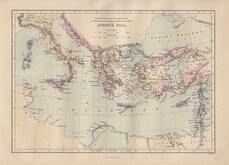
Journeys of Paul 1870
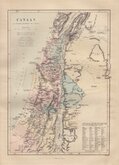
Canaan Tribes of Israel 1870
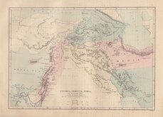
Assyria Armenia Syria 1870
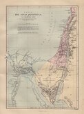
Sinai Peninsula 1870
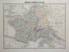
France en 1811 1878
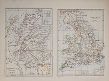
England & Scotland set 1884
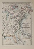
World N America India 1884
Roman Empire 1884

Request
Condition Report
COUNTRIES Between EGYPT AND CANAAN, The supposed Route of the Israelites Coloured Red.
Published by William Collins. London & Glasgow.
Published in William Collins' Practical and Devotional Family Bible...Commentaries of Henry and Scott. Condensed by the Rev. John M.cFarlane, L.L.D. Glasgow...Glasgow William Collins, Buchanan Street. 1861.
Vignette: PYRAMIDS OF GHIZEH EGYPT I will make the land waste_I wull cause the Idols to cease out of Noph Ezekie XXIX.XXX.
Lithograph overprinted in yellow with hand applied red line.
Quick Links

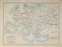
Europe

Road Maps
×