
Hertfordshire Prints
Hertfordshire Maps
( Page 6 of 11 )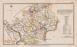
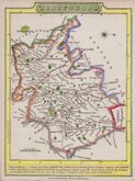
Henry Cooper 1808
John Cary 1808 [1809]
James Wallis 1812
James Wallis 1812 [c.1819]
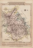
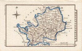
Samuel John Neele 1819
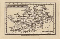
Robert Miller 1819 [1821]
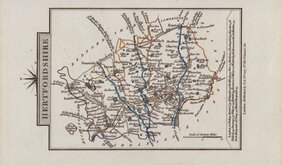
Sidney Hall 1820
John Cary 1822


23x18 cm
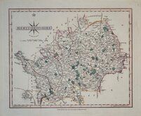
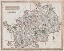
FOURTH STATE SHOWING THE POOR LAW UNIONS.
HERTFORDSHIRE
Drawn by R.Creighton. | Engraved by J. & C. Walker
DRAWN AND ENGRAVED FOR LEWIS' TOPOGRAPHICAL DICTIONARY.
Copper engraving by J & C Walker from a drawing by Roger Creighton issued in A Topographical dictionary of England… published by Samuel Lewis and Co. from 1831. The work achieved considerable success and was re-issued many times by Lewis until 1849. During this time the maps were amended and updated to include electoral information and the rapidly expanding railway network, with most counties known in at least six different states.
This example is the fourth state of the plate with the addition of the Poor Law Unions highlighted in original hand colour. Issued from 1840 to 1845.
Hodson Printed Maps of Hertfordshire ref. 93 (iv)
Quick Links


Essex Maps

Middlesex Maps
×