
Essex Maps
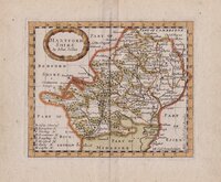
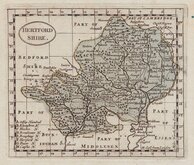
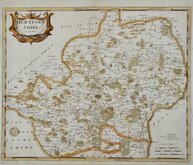
Hertfordshire Maps
( Page 2 of 11 )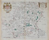
Richard Blome 1673
John Seller 1694
John Seller 1694 [c.1784]
Robert Morden 1695
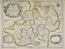
John Oliver 1695
Robert Morden 1695
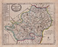
Robert Morden 1701 [1708]
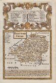
Emanuel Bowen 1720


9x12 cm
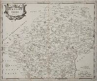
RARE "UPSIDE-DOWN" SERIES
HERTFORDSHIRE.
The engraver or engravers of this series of maps are unknown. Robert Butters, a Fleet Street printer, issued them in An Atlas of England... in 1803. They are known as the "upside-down series" as many of the maps are engraved with North to the bottom of the page. In fact, the county maps are variously orientated with North to the top, left, right or bottom of the page. The work was possibly intended for school use and the odd orientation of the maps may have been done to appeal to young minds. This represented Robert Butters' only serious venture into cartography but unlike the huge success of John Cary's publication The Traveller's Companion, on which these maps were based, Butter's publication was limited to this single issue. John Hatchard acquired the plates later the same year issuing them in a two-volume work, The Picture of England 1803 and 1804. The publications were small and surviving examples are rare.
Hertfordshire is orientated with North to the left of the page.
Tape stains to all paper edges. Closed split at the plate edge below title and to lower left edge. The printed area is unaffected and the map is clean. A conservation mount is offered with this map at checkout which conceals these condition issues.
A rare map in original hand colour.
Ref. Hodson Printed Maps of Hertfordshire 62.
Quick Links


Middlesex Maps

Hertfordshire Prints
×