
Hertfordshire Prints
Hertfordshire Maps
( Page 5 of 11 )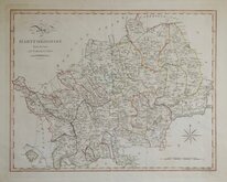
John Cary 1789 [1805]
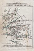
John Cary 1791
Francis Vivares 1794
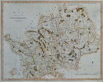
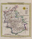
John Stockdale 1798
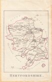
Robert Butters 1803
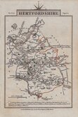
Cole & Roper 1805
John Cary 1806
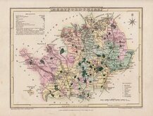
Charles Cooke 1806 [c.1824]


52x43 cm
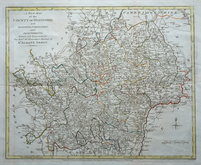
PUBLISHED IN CLUTTERBUCK’S HISTORY. A Map of the COUNTY OF HERTFORD. A poor copy with areas of loss at repaired damage to binding fold, several creases, staining and marking.
Engraved by I. Cross. 18, Holborn Hill.
London: Published 1st. June 1827. by I.B. Nichols & Son, Printers, 25 Parliament Street, Westminster.
Engraved by Joseph Cross for publication in The History and Antiquities of the county of Hertford…By Robert Cutterbuck,,, London, John Bowyer Nichols, 1827. The map is based on the Jones & Smith map of 1801 but includes information from the large scale survey of 1822 by Andrew Bryant. The map was not used for any other publication.
Ref. Hodson Printed Maps of Hertfordshire 89
Quick Links


Essex Maps

Middlesex Maps
×