
Hertfordshire Prints
Hertfordshire Maps
( Page 9 of 11 )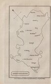
William Cobbett 1832
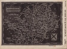
Joshua Archer 1833
Robert Gray 1833 [c.1840]
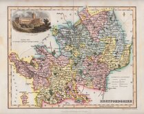
Christopher & John Greenwood 1834
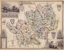
Thomas Moule 1837
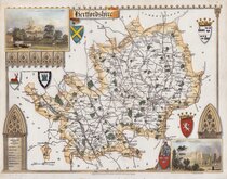
Thomas Moule 1837
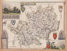
Thomas Moule 1837 [c.1845]
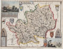
Thomas Moule 1837 [c.1845]

Request
Condition Report
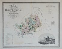
THE FIRST MAP OF THE COUNTY TO BE PRINTED BY LITHOGRAPHY.
The County of HERTFORD With Additions & Corrected and Amended in many Places. H. Moll Fecit, A.o 1700.
Drawn on Stone from the Original Engraving by C.L.Tyler
Published by J.M.Mullinger Bishops Stortford. 1826.
Published in the second edition of Sir Henry Chauncy's Historical Antiquities of Hertfordshire in 1826. Closely copied from the copper engraved map by Herman Moll, retaining the original date in the title. This was the first map of Hertfordshire to be printed by the newly invented lithographic process, the design being drawn by hand directly on the stone.
Folds as issued and with an archival repair to a short tear at the original binding fold but generally in very good condition for this map usually found in poor condition, being folded into the octavo volume. Good later hand colour.
REF. Hodson Printed Maps of Hertfordshire 88
Quick Links


Middlesex Maps

Essex Maps
×