
Essex Maps
Hertfordshire Maps
( Page 6 of 11 )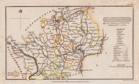
Henry Cooper 1808
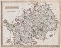
John Cary 1808 [1809]
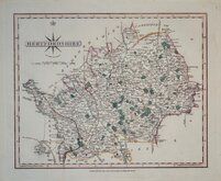
James Wallis 1812
James Wallis 1812 [c.1819]
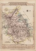
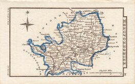
Samuel John Neele 1819
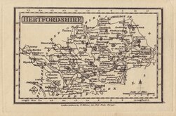
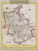
Robert Miller 1819 [1821]
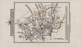
Sidney Hall 1820
John Cary 1822


42x34 cm
PUBLISHED IN CUSSAN'S HISTORY OF HERTFORDSHIRE.
HERTFORDSHIRE, FOR CUSSANS’S HISTORY OF HERTFORDSHIRE 1869.
First issued as loose sheets sold separately lithograph printed and hand coloured by George Philip and Son in 1864, then overprinted in colours in Philip's atlas of the Counties of England, reduced from the Ordnance Survey. By Edward Weller, F.R.G.S., George Philip and Son, 1864. The map was used extensively over the next 40 years undergoing many changes in various titles published by Philips and by Iliffe & Son, with the final appearance in The Hertfordshire Almanac Stephen Austin and Sons 1901 to 1905.
This example is the second lithographic transfer with a number of changes to the plate, mainly to the expanding railway network, and changes to the imprint and title published in Cussan's History of Hertfordshire in 1870.
Additional horizontal fold with some wear at fold intersection repaired with archival tape verso. A clean example in neat original hand colour.
Ref. Hodson Printed maps of Hertfordshire 115 B.
Quick Links


Hertfordshire Prints

Middlesex Maps
×