
Essex Maps
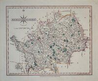
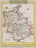
Hertfordshire Maps
( Page 6 of 11 )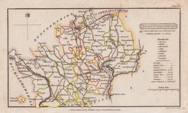
Henry Cooper 1808
John Cary 1808 [1809]
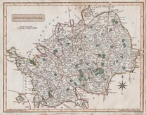
James Wallis 1812
James Wallis 1812 [c.1819]
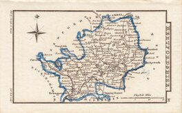
Samuel John Neele 1819
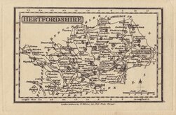
Robert Miller 1819 [1821]
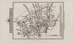
Sidney Hall 1820
John Cary 1822


49x39 cm
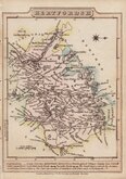
UNCOMMON MAP FROM THE ROYAL ENGLISH ATLAS
An Accurate Map of HARTFORD SHIRE Divided into HUNDREDS; Drawn from Surveys and Illustrated with Historical Extracts relative to its Natural Produce, Trade and Manufactures; Describing also the Church Livings, Charity Schools, &c. with other Improvements by Eman: Bowen Geogr,, to his late Majesty.
This series of maps, produced for The Royal English Atlas, were a reduction by two thirds of the maps from The Large English Atlas and were first published in 1763 only three years after the first complete issue of the Large English Atlas. There were a number of re-issues in the 1770's and 1780's with the final publication in 1828 by R. Martin but the publications were small and the work was not a commercial success, the maps are scarce today.
This Hertfordshire map has been trimmed to plate edge with loss of imprint which prevents identification of the specific edition. It has also been folded with slight browning at folds and some minor loss at fold intersections. Re-margined in matching paper and repaired and re-inforced at fold lines verso. Despite its faults it remains a detailed and decorative map in original hand colour and the good dark impression would suggest an early edition.
Ref. Hodson Printed maps of Hertfordshire r42
Quick Links


Middlesex Maps

Hertfordshire Prints
×