
Hertfordshire Prints
Hertfordshire Maps
( Page 7 of 11 )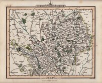
Charles Smith 1822 [c.1829]
Aristide Perrot 1824
William Ebden 1825 [c.1833]
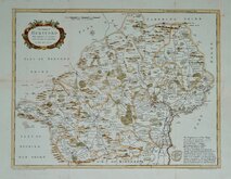
Herman Moll 1826
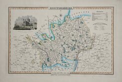
James Pigot 1826 [1846]
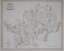
Joseph Cross 1827
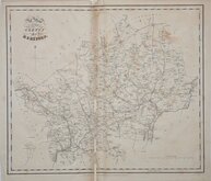
Joseph Cross 1827
T L Murray 1830 [1832]


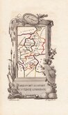
18x10 cm
FIRST ISSUE. ALSO KNOWN AS "CAPPER" MAPS.
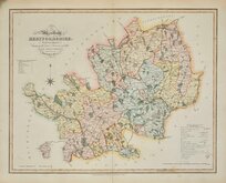
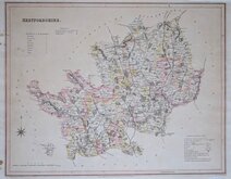
Plate XVI.
HERTFORDSHIRE
Cooper del.t et sculp.t
Published Jan.y 1.1808. by R.Phillips, Bridge Street, Blackfriars, London.
Engraved by Henry Cooper (fl.1804-1819), engraver and mapseller probably born in London about 1782, the son of Henry Cooper, a lighterman of Beer Lane, Tower Street. The maps were produced for publication in A Topographical dictionary of the United Kindom...Accompanied by forty-six maps, drawn purposely for this work, on an original plan. By Benjamin Pitts Capper, Esq. London, Richard Philips, 1808.
The work was re-issued by publishers Longman, Hurst, Rees, Orme and Brown in 1813, by George B. Whittaker in 1825 & 1826, Richard Philips in 1829 & 1834, and by Whittaker & Co. in 1839.
This example, with the imprint of R. Philips, is the first state of the plate published by Phillips in 1808 and Longman et al. in 1813.
Some spotting particularly in the margins but otherwise good in neat outline hand colour.
Ref. Hodson Printed Maps of Hertfordshire 68(i).
Quick Links


Essex Maps

Middlesex Maps
×