
Essex Maps
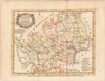
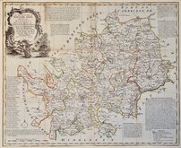
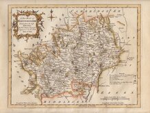
Hertfordshire Maps
( Page 4 of 11 )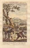
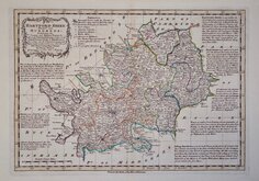
George Bickham 1751 [1754]
Emanuel Bowen 1759
Emanuel Bowen 1763
Thomas Kitchin 1763
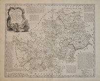
Emanuel Bowen 1763 [c.1779]
Emanuel Bowen 1767 [1770]
John Haywood 1788
Joseph Johnson 1788 [c.1790]


52x43 cm
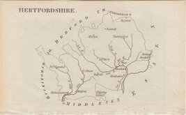
PUBLISHED IN CLUTTERBUCK’S HISTORY.
A Map of the COUNTY OF HERTFORD.
Engraved by I. Cross. 18, Holborn Hill.
London: Published 1st. June 1827. by I.B. Nichols & Son, Printers, 25 Parliament Street, Westminster.
Engraved by Joseph Cross for publication in The History and Antiquities of the county of Hertford…By Robert Cutterbuck,,, London, John Bowyer Nichols, 1827. The map is based on the Jones & Smith map of 1801 but includes information from the large scale survey of 1822 by Andrew Bryant. The map was not used for any other publication.
A few repairs to edge tears including two extending into the map border. Some additional light creasing. Vertical printers crease from bottom margin to Baldock. Small top margin. Watermark for Balston & Co. 1827. Despite these issues the map remains an uncommon, decorative, neatly engraved map with clear topographical detail.
Ref. Hodson Printed Maps of Hertfordshire 89
Quick Links


Hertfordshire Prints

Middlesex Maps
×