
Whole of Britain & British Isles
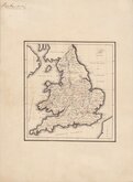
England & Wales
( Page 5 of 5 )

42x53 cm
MAP OF THE CANALS AND RIVERS
MAP OF THE CANALS AND NAVIGABLE RIVERS, IN ENGLAND WALES AND SCOTLAND: Compiled from the Latest & Best Authorities for Baines' Lancashire BY WILLIAM SWIRE, SURVEYOR, LEEDS.
Large copper engraving by Sidney Hall (1788?-1831) issued in The History of Lancashire by Edward Baines published 1824 & 1836.
Uncommon but a poor example with several folds some split and repaired with archival tape. Slight loss at one fold intersetction (centre of Cheshire). Re-margined bottom half of left edge. Original hand colour faded.
Quick Links

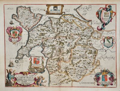
Wales Maps

Scotland Maps
×