
Whole of Europe
Eastern Europe & Turkey
( Page 5 of 8 )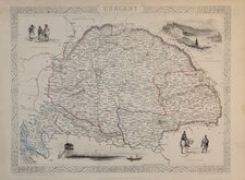
Hungary 1851
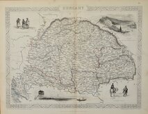
Hungary 1851
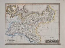
Prussia by James Wyld 1817
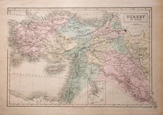
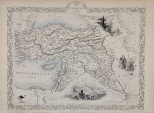
Turkey in Asia A & C Black 1840
Turkey by Rapkin 1851
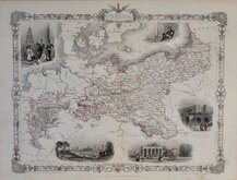
Prussia by Rapkin 1851
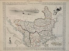
Turkey in Europe Rapkin 1851
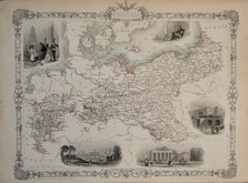
Prussia by Rapkin 1851


58x45 cm
SOUTH-WEST RUSSIA
Showing the extent of THE KINGDOM OF POLAND previous to its partition in 1772 BY KEITH JOHNSTON, F.R.S.E.
by W.& A.K. Johnston, Edinburgh.
William Blackwood & Sons, Edinburgh & London.
Double page lithographic printed map by Alexander Keith Johnston (1804-1871), published in The Royal Atlas of Modern Geography...by Alexander Keith Johnston Geographer to the Queen for Scotland...William Blackwood & Sons, Edinburgh and London, 1861.
Overprinted in blue, indicating rivers and seas, and hand coloured to indicate political boundaries.
Very good condition.
Quick Links


Asia

Mediterranean
×