
Bedfordshire Maps
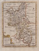
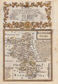
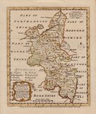
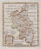
Buckinghamshire Maps
( Page 1 of 4 )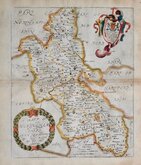
Richard Blome 1673
John Seller 1694 [1784]
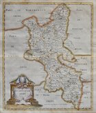
Robert Morden 1695
Robert Morden 1695 [1753]
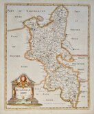
Robert Morden 1701 [c.1708]
Emanuel Bowen 1720
Emanuel Bowen 1758
Emanuel Bowen 1758


18x24 cm
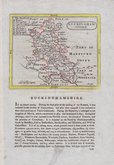
BUCKINGHAMSHIRE
Drawn & Engraved by J.Archer, Pentonville, London.
Frst published in Curiosities of Great Britain, England and Wales Delineated…by Thomas Dugdale by L.Tallis in 1842. The work was re-issued a number of times until 1860. The maps also appeared in The Universal English Dictionary…by the Rev. James Barclay and finally in Tallis's topographical dictionary of England & Wales in 1860.
This example is from the 1848 edition of Dugdales Curiosities in original hand colour.
Quick Links


Berkshire Maps

Road Maps
×