
Berkshire Prints
Berkshire Maps
( Page 1 of 4 )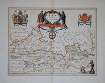
Jan Blaeu 1645
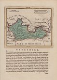
John Seller 1694 [1784]
John Seller 1694 [1784]
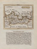
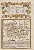
Robert Morden 1695 [1753]
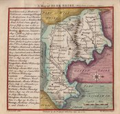
Emanuel Bowen 1720
Thomas Badeslade 1742
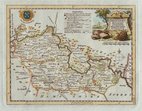
Thomas Kitchin 1751 [1786]
Emanuel Bowen 1756 [1763]


24x18 cm
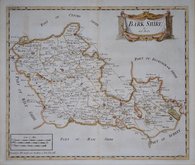
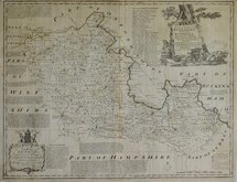
ORIGINAL HAND COLOUR SHOWING THE POOR LAW UNIONS
BERKSHIRE
Drawn by R.Creighton. | T.Starling sc. Wilmington Square.
DRAWN AND ENGRAVED FOR LEWIS' TOPOGRAPHICAL DICTIONARY.
Copper engraving by Thomas Starling from a drawing by Roger Creighton issued in A Topographical dictionary of England… published by Samuel Lewis and Co. from 1831. The work achieved considerable success and was re-issued many times by Lewis until 1849. During this time the maps were amended and updated to include electoral information and the rapidly expanding railway network, with most counties known in at least six different states.
Some light spotting but still a good example of the map of Berkshire with the addition of the poor-law unions outlined in original hand colour issued from 1840 to 1845.
Quick Links

Road Maps

Bedfordshire Maps
×