
Road Maps
Berkshire Maps
( Page 1 of 4 )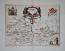
Jan Blaeu 1645
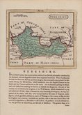
John Seller 1694 [1784]
John Seller 1694 [1784]
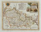
Robert Morden 1695 [1753]
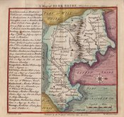
Emanuel Bowen 1720
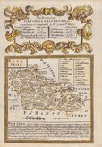
Thomas Badeslade 1742
Thomas Kitchin 1751 [1786]
Emanuel Bowen 1756 [1763]


24x18 cm
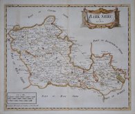
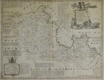
"COLE & ROPER" This map of Berkshire includes the indication of polling places and was issued between 1838 & 1842 in Dugdale's Curiosities of Great Britain.
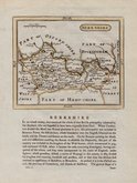
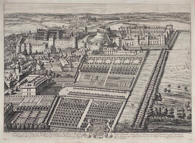
BERKSHIRE
Engraved by John Roper (1771-1810), a London engraver and copperplate printer trading from New Street Square from 1797 until his death in 1810. His widow, Mary Roper, continued the business at the same address until at least 1846. This series of maps, most drawn by George Cole, were intended to accompany The Beauties of England and Wales. The maps were not actually published with this work but first issued in parts as a separate series between 1804 and 1810 and first appearing in atlas form in The British Atlas published by Vernor Hood & Sharpe (& nine other publishers) in 1810. The maps were re-issued in several publications including Dugdale's Curiosities of Great Britain until 1843. Their final appearance was by lithographic transfer in Collins' railway and pedestrian atlas… published by Darton and Co. in 1858.
Original hand colour. Creasing to centrefold.
Quick Links

Berkshire Prints

Bedfordshire Maps
×