
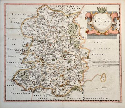
Shropshire Maps
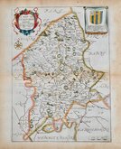
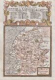
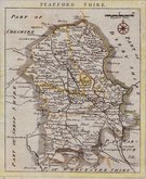
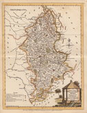
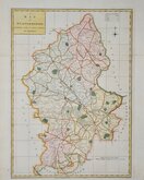
Staffordshire Maps
( Page 1 of 4 )
John Speed 1610 [1676]
Richard Blome 1673

Robert Morden 1695
Emanuel Bowen 1720
Thomas Read 1744 [c.1769]
Joseph Ellis 1765 [1773]

John Cary 1789 [1805]
John Haywood 1791


31x44 cm
THE DISPATCH ATLAS
B R DAVIES
STAFFORDSHIRE. BY JOHN DOWER.
Weekly Dispatch atlas, 139 Fleet street. | Drawn & Engraved by John Dower, Pentonville Hill London.
Day & Son Lithrs. to The Queen.
The map was drawn and engraved on copper John Dower and transferred to stone for lithographic reproduction by Day & Son, the engraved plate was not used for direct intaglio printing. The first publication was in the Weekly Dispatch Newspaper between 1856 and 1862, followed by loose sheet issues and when the series was complete, in The Dispatch Atlas in 1863.
Some repaired nicks to edges, some occasional light creasing, spotting to lower margin and a brown spot near Shiffnal, otherwise good, in original hand colour from The Weekly Dispatch Atlas 1863.
Quick Links

Derbyshire Maps

Worcestershire Maps
×