
Worcestershire Maps
Staffordshire Maps
( Page 1 of 4 )
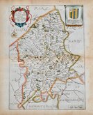
John Speed 1610 [1676]
Richard Blome 1673

Robert Morden 1695
Emanuel Bowen 1720
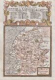
Thomas Read 1744 [c.1769]
Joseph Ellis 1765 [1773]

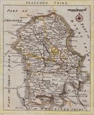
John Cary 1789 [1805]
John Haywood 1791


31x44 cm
CASSELL EDITION WITH PARLIAMENTARY NOTES.
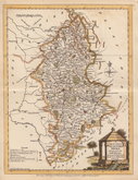
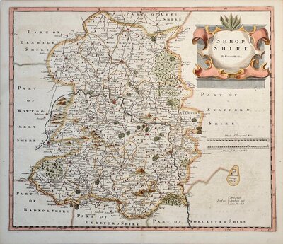
STAFFORDSHIRE BY JOHN DOWER.
LONDON. PUBLISHED BY CASSELL, PETTER & GALPIN, LA BELLE SAUVAGE YARD, LUDGATE HILL. E.C.
Drawn and engraved on copper by John Dower and transferred to stone for lithographic reproduction by Day & Son, the engraved plate was not used for direct intaglio printing.
Fine hand coloured example from the second issue with the addition of topographical, statistical and parliamentary notes transferred to the stone from type below the title. Published in Cassell's British Atlas.. 1867
Quick Links


Derbyshire Maps
Shropshire Maps
×