
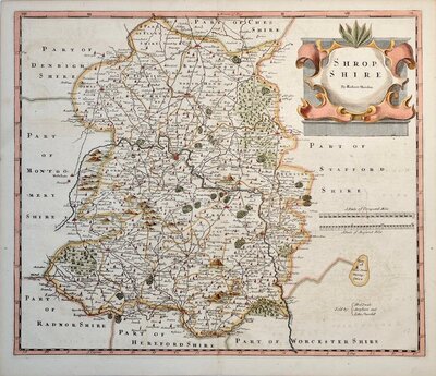
Shropshire Maps
Staffordshire Maps
( Page 1 of 4 )
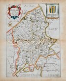
John Speed 1610 [1676]
Richard Blome 1673

Robert Morden 1695
Emanuel Bowen 1720
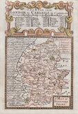
Thomas Read 1744 [c.1769]
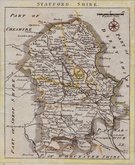
Joseph Ellis 1765 [1773]

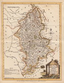
John Cary 1789 [1805]
John Haywood 1791


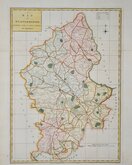
10x15 cm
CARY'S MINIATURE SERIES.
STAFFORDSHIRE
London. Published by G & J Cary. No.86 St.James's Str.
A re-engraved and revised version of of the map issued by John Cary in 1806 which in turn, was a re-engraved version of his 1789 map. All were issued under the title of Cary's Traveller's Companion, a highly successful work necessitating the re-engraving of worn plates to continue publication. This version was published with his brother George, between 1822 and 1835. The final issue was by lithographic transfer in Crutchleys' Railroad Companion to England and Wales...in 1862.
1st state of the re-engraved plate in original hand colour. Light thumb marking bottom corner.
Quick Links

Worcestershire Maps

Derbyshire Maps
×