
Map Books
Sea Charts
( Page 2 of 3 )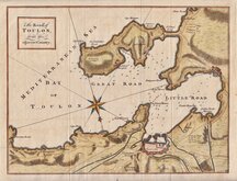
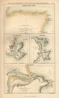
Bay of Toulon 1759
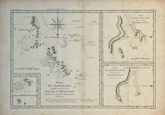
Kerguelen Islands, Desolation Islands 1788
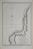
Sakhalin La Perouse 1798
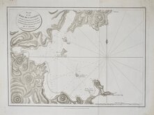
De-Kastri Perouse 1798
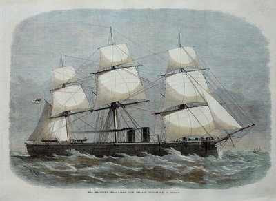
Ports and Harbours 1860
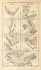
Ports and Harbours 1860
Ports and Harbours 1860
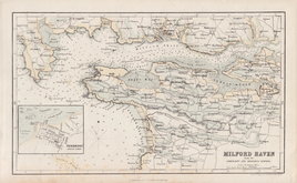
Milford Haven 1866


25x37 cm
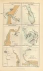
PLAN OF LA BAIE | D'ESTAING | on the Eastern Coast of Tchoka in 48o.59'.38". | of Latitude North and 140o. 0'. 42". of Longitude East. | taken from the Anchorage of the Astrolabe. | This Bay was discovered 20 July 1787, by the | Boussole & Astrolabe commanded by Mesrs. | DE LA PEROUSE AND DE LANGLE. | The Needle experienced no variation. The bottom where the | soundings are marked is Sand, Mud & Shells. | The whole bay was not sounded.
Neele sc. Strand
Published as the Act directs, Nov.r 1.st 1798, by G.G & J.Robinson, Paternoster Row, London.
Jean-Francois de la Perouse (1741-1788) joined the French navy at the age of fifteen and fought against the British in the Seven Years War. After the war he led an expedition around the world to complete the Pacific discoveries of James Cook. Among his many surveys he charted most of the Strait of Tartary and the islanders he encountered told him that the island was called "Tchoka". The island is known as Sakhalin today.
Good clean example.
Quick Links
Maritime

Mediterranean
×