
Whole of France
Parts Regions & Departments of France
( Page 14 of 19 )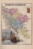
Charente Inferieure & Cher 1877
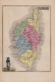
Corsica 1877
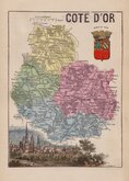
Cote d'Or & Cotes du Nord 1877
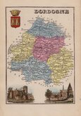
Dordogne & Creuse 1877
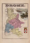
Drome & Doubs 1877
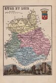
Eure & Eure et Loire 1877
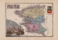
Finistere & Gard 1877
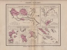
French Colonies 1877

£15 Charente Inferieure & Cher
Ref: ab6078.13
Add to
basket
Thanks,Your Product Has Been Added To Basket

13x18 cm
CHARENTE-INFERIEURE
ARMES DE LA ROCHELLE. PORT DE LA ROCHELLE. FONDERIE GENÉRALE. PEGARD SC.
CHER
ARMES DE BOURGES. VUE DE BOURGES. FONDERIE GÉNÉRALE.
Two hand coloured wood engraved maps with arms and vignettes printed on each side of the page. Published in Petit Atlas National...Paris Librairie Historique et Scientifique 1877.
The maps were issued earlier in Atlas et Geographie de La France... par De La Brugere...Paris 1866.
Quick Links

Mediterranean

Whole of Europe
×