
Whole of Ireland
Parts of Ireland & Counties
( Page 2 of 5 )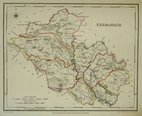
Fermanagh 1846
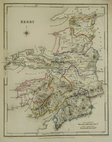
Kerry 1846
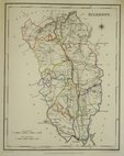
Kilkenny 1846
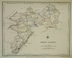
Kings County 1846
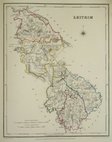
Leitrim 1846
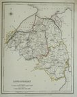
Limerick 1846
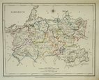
Londonderry 1846
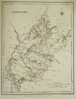
Longford 1846


18x23 cm
County map drawn by Roger Creighton and engraved by John Dower for publication in Samuel Lewis's Atlas of the Counties of Ireland published to accompany his Topographical Dictionary in 1846.
Original hand outline colour.
Liht waterstain top rigtht corner.
Quick Links

Wales Maps

Scotland Maps
×