
Scotland Maps
Parts of Ireland & Counties
( Page 4 of 5 )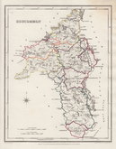
Roscommon 1846
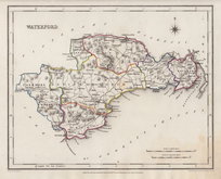
Waterford 1846
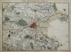
Environs of Dublin 1852
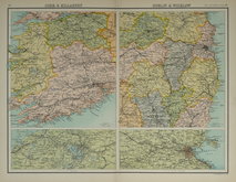
Killarney & Wicklow 1898
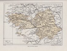
Galway 1924
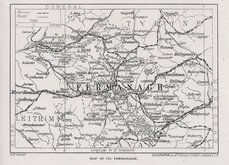
Fermanagh 1924
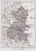
Dublin 1924
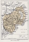
Down 1924


23x18 cm
County map drawn by R. Creighton and engraved by J. Dower for publication in Lewis's Atlas of the Counties of Ireland published in 1846 to accompany his Topographical Dictionary.
Original hand outline colour.
Quick Links


Wales Maps
Whole of Ireland
×