
Scotland Maps
Northumberland Maps
( Page 4 of 4 )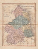
Joshua Archer 1842 [1858]
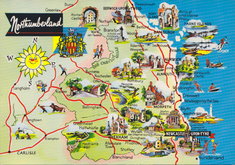
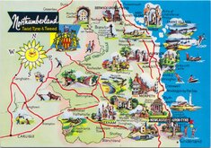
Northumberland Map Postcard 1965
Northumberland Map Postcard 1965
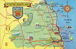
Northumberland Map Postcard 1990


49x55 cm
CARY'S "FOLIO" SERIES. FINE EXAMPLE FROM THE FIRST ISSUE IN ORIGINAL HAND COLOUR AND WITHOUT CENTREFOLD.
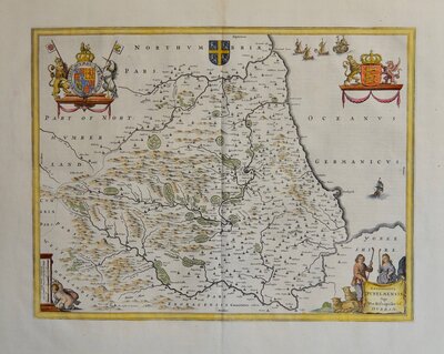
A NEW MAP OF NORTHUMBERLAND, DIVIDED INTO WARDS EXHIBITING Its Roads, Rivers, Parks &c. By John Cary Engraver. 1807.
London Published by J.Cary Engraver & Map seller N.o 181 Strand Mar. 1.st 1807.
John Cary (c.1754-1835) began publishing his series of folio county maps in parts issues from 1801, the complete series being published in Cary's New English Atlas in 1809. The atlas was deservedly successful running to over ten editions before Cary's death. The plates passed to G F Cruchley about 1846 and to Gall and Inglis in 1877 and were issued by both publishers under various titles by lithographic transfer with continuous amendments, particularly to the rapidly changing railway network, until their final appearance in Cruchley's railway and telegraphic county atlas of England and Wales published by Gall and Inglis about 1887.
In addition to this extended publication in atlas form, the maps were also issued continuously from 1801 to 1890 as folding maps sold separately. The plates were probably disposed of as scrap metal during the first world war.
This fine example of the county of Northumberland, in full original hand colour, dated 1807, is from the first atlas edition of 1809 or from an earlier parts issue, probably later bound into an atlas, a pasted page number (27) to lower right corner of the sheet suggests the latter. Unusual without centrefold.
Ref. Whitaker Maps of Northumberland 319
Quick Links


Cumberland Maps
Durham Maps
×