
Yorkshire Maps
Lancashire Maps
( Page 1 of 3 )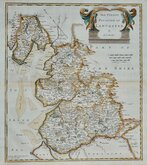
Robert Morden 1695

Emanuel Bowen 1720

Thomas Kitchin 1750 [c.1786]
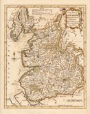
Thomas Kitchin 1763
John Cary 1787 [1808]
John Cary 1789 [1805]
Henry Cooper 1808 [c.1825]

John Cary 1822


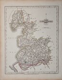
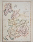
28x22 cm
PAIR OF MAPS. LITHOGRAPH PRINTED COLOUR.
LANCASHIRE NORTH PART
F.S.Weller, F.R.G.S.
WILLIAM MACKENZIE, LONDON, EDINBURGH & GLASGOW
LANCASHIRE SOUTH PART
F.S.Weller, F.R.G.S.
WILLIAM MACKENZIE, LONDON, EDINBURGH & GLASGOW
Pair of colour lithograph printed maps from engravings by Francis Sidney Weller (1849-1910), son of mapmaker Edward Weller, published by William Mackenzie in The Comprehensive Gazetteer of England and Wales issued in parts from c.1891-1895. The plates from which the lithographs wwere taken were not used for direct intaglio printing. The map is based on the New Series One Inch Ordnance Survey and has been overprinted in colours showing the county divided into local administrative units.
Quick Links

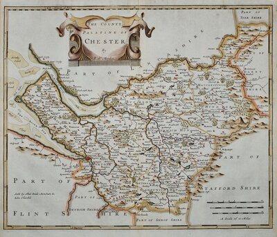
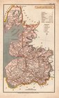
Cheshire Maps

Westmorland Maps
×