
Mediterranean
Italy
( Page 1 of 3 )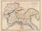
North Italy & Switzerland. Hall 1826
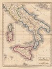
South Italy, Sicily, Sardinia & Corsica. Hall 1826
South Italy, Sicily & Malta. Starling 1831
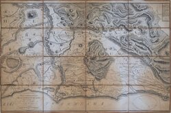
Environs of Rome. Sickler 1832
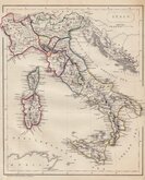
Italy, Sicily, Sardinia & Corsica. Becker 1850
South Italy, Sicily Sardinia & Corsica. Rapkin 1851
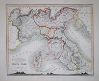
North Italy & Corsica by Petermann 1854
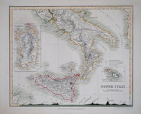
South Italy, Sicily, Sardinia & Malta by Petermann 1854

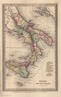
£25 South Italy, Sicily, Sardinia & Malta. Johnston
Ref: 6036.14
Add to
basket
Thanks,Your Product Has Been Added To Basket

58x45 cm
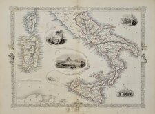
SOUTH ITALY | AND THE ISLAND OF | SARDINIA | BY KEITH JOHNSTON. F.R.S.E.
Large, highly detailed lithographic printed map published in The Royal Atlas Of Modern Geography Exhibiting, in a series of entirely original and authentic maps, the present condition of geographical discovery and research in the several countries, empires, and states of the World by Alexander Keith Johnston geographer to the Queen for Scotland...William Blackwood & Sons Edinburgh and London MDCCCLXIX.
Overprinted in blue indicating rivers and sea and hand coloured in line and wash indicating political boundaries.
Also showing Sicily, Malta and Gozo with inset map of the Bay of Naples.
A smudge in the blank area of sea otherwise a good example.
Quick Links


Whole of Europe
Spain & Portugal
×