
Durham Prints
Durham Maps
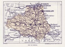
( Page 4 of 4 )

33x27 cm
DETAILED TOPOGRAPHY AND RAILWAY NETWORK
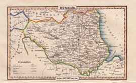
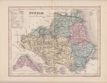
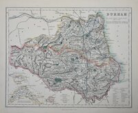
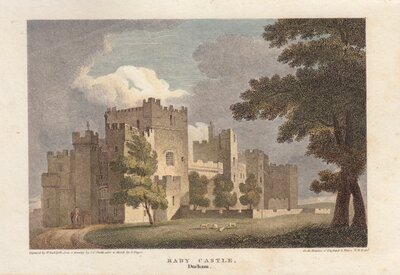
DURHAM.
Drawn by F.P. Becker & Co. 12 Paternoster Row. | Engraved on Steel by the Omnigraph, F.P. Becker & Co. Patentees.
FISHER, SON, & Co. LONDON & PARIS.
This series of maps were begun by James Gilbert whose name appears on the first ten maps produced with Joshua Archer’s signature as engraver. Gilbert did not continue with the project and Fisher, Son & Co took over, using Francis Paul Becker (1807-1863), as engraver. Becker patented the "Omnigraph" process of transferring letter press to copperplate.
The maps were issued in parts as they were completed from 1842. The series was not complete until 1845 and published in Fisher’s county atlas of England and Wales. Compiled from authentic surveys, corrected to the present time…London, Liverpool and Manchester, Fisher, Son and Co., [1845]. The date is taken from the general map. One further issue, also undated has the date on the general map changed to 1846.
Very good in neat original hand colour.
Quick Links

Northumberland Maps

Yorkshire Maps
×