
Yorkshire Maps
Durham Maps
( Page 1 of 4 )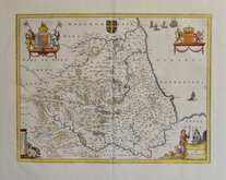
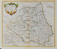
Jan Blaeu 1645 [c.1648]
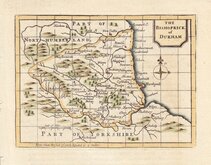
Richard Blome 1676
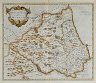
John Seller 1694 c.1784
John Seller 1694 [c.1784]
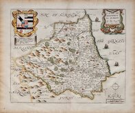
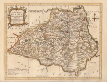
Robert Morden 1695 [1722]
Robert Morden 1695 [1753]
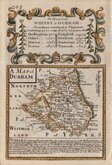
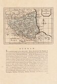
Owen & Bowen 1720
Thomas Kitchin 1763


12x18 cm
"OWEN & BOWEN"
A MAP of DURHAM
Map set below a decorative cartouche containing the title and details of the road from Whitby to Durham
Road map of the final part of the route from Shrewsbury to Durham verso.
Engraved by Emanuel Bowen (1693?-1767) and published in the pocket road book Britannia Depicta by Thomas Bowles from 1720 to 1764. The county maps were based on Robert Morden's small series published in The New Description and State of England... from 1701. Text descriptions compiled by John Owen.
This map is also listed under road maps; for full description of the road, go to the listing under category: RoadMaps > Owen & Bowen.
For more information on Britannia Depicta, see the description in the category heading under Road Maps > Owen & Bowen.
Quick Links


Northumberland Maps
Durham Prints
×