
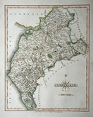
Westmorland Maps
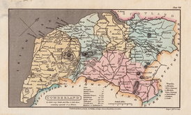
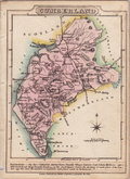
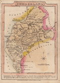
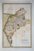
Cumberland Maps
( Page 3 of 6 )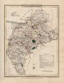
George Cole 1805
Henry Cooper 1808
John Cary 1808 [1809]
James Wallis 1812
James Wallis 1812 [1814]
Daniel & Samuel Lysons 1816
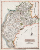
Samuel Neele 1819
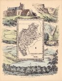
Reuben Ramble 1819 [1845]


45x60 cm
CUMBERLAND AND WESTMORLAND ON TWO SHEETS. FIRST NEWSPAPER ISSUE.
THE DISPATCH ATLAS
CUMBERLAND AND WESTMORLAND BY EDWARD WELLER. F.R.G.S.
Weekly Dispatch Atlas. 139 Fleet Street. DIVISION (CUMBERLAND & WESTMORLAND NORTH SHEET) | E. Weller Lithog.r
Partial stamp to bottom left corner: SUPPLEMENT TO THE .. OF SUNDAY NOVR 23RD 1862.
WESTERN THE LAKE DISTRICT (CUMBERLAND % WESTMORLAND , SOUTH SHEET) THE DISPATCH ATLAS
Weekly Dispatch Atlas. 139 Fleet Street. E. Weller Lithog.r Engraved by Edw.d Weller, 34 Red Lion Square.
Partial stamp in pink ink to top right corner: SUPPLEMENT TO THE .. OF SUNDAY NOVR 23RD 1862
Commencing publication in 1859, this series of maps were printed by lithographic transfer from an engraved plate for The Weekly Dispatch Newspaper. The engraving work for the series was shared between Edward Weller, John Dower, and Benjamin Rees Davies. The maps were published in parts issues and when the series was complete, in The Dispatch Atlas in 1863. The publishers Cassell Petter and Galpin acquired the plates publishing them as loose sheets from 1864 and in Cassell's Illustrated family paper and Cassell's British Atlas in 1867. By 1869, the firm of G. W. Bacon had acquired the plates and published them in a number of titles for over forty years.
Edward Weller (1819-1884) mapmaker, engraver, lithographer and printer, was born in London on 1st July 1819. He was left £50 in 1831 by his uncle, engraver and copperplate printer, Sidney Hall (1788?-1831) to pay for his apprenticeship. His output was considerable, producing maps from 1852 until his death in 1884, and included maps for Philips County Atlas 1857, The Imperial Atlas for Blackie & Sons 1860, A Middle Class Atlas of General Geography Macleod 1864, four atlases for Francis Collier, 109 maps for the Royal Geographical socieybetween 1857 and 1872, and maps for Murray's Handbooks.
He married Mary Ann Ward 31 May 1847. On the 1851 census he was described as a map engraver living at Cadogan Terrace, Chelsea, with his wife, three children, two servants and a lodger. He was elected Fellow of the Royal Geographical Society 14 April 1851. On the death of his aunt, Selina Hall in 1853, he inherited the Hall business in Bury Street, Bloomsbury. On the 1861 census he is described as a painter living in Red Lion Square with his wife, six chldren and two servants, on the 1871 census he is given as a geographical engraver and lithographic printer at the same address with his wife six daughters and a servant. The 1881 census records that he was employing fourteen men and four boys with his household now comprising his wife, five unmarried daughters, a housemaid and a cook. He died at Red Lion Square 17th May 1884 his estate valued at £7,626.6s.5d. passed to his wife Mary Ann. His son Francis Sydney Weller (1849-1910 was also a mapmaker.
This map of Cumberland and Westmorland is printed on 2 separate sheets from The Weekly Dispatch Newspaper.
Closed tear to top margin of North sheet not affecting printed area. Original outline hand colour. Each map measures approx 45x30cm. to give an overall map size approx 45x60 cm.
Quick Links


Northumberland Maps

Scotland Maps
×