
Northumberland Maps
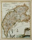
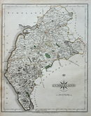
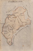
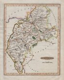
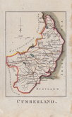
Cumberland Maps
( Page 2 of 6 )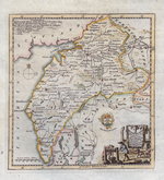
Thomas Kitchin 1750 [1786]
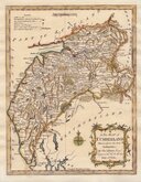
Thomas Kitchin 1763
Joseph Ellis 1765 [1773]
John Cary 1787 [1793]
Joseph Johnson 1790
Benjamin Baker 1791
Robert Butters 1803
Jones & Smith 1804


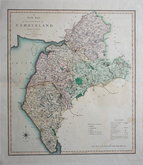
18x23 cm
ORIGINAL WASH COLOUR.
CUMBERLAND
Drawn & Engraved by J.Archer, Pentonville, London.
First published in Curiosities of Great Britain, England and Wales Delineated…by Thomas Dugdale by L.Tallis in 1842. The work was re-issued a number of times until 1860. The maps also appeared in The Universal English Dictionary…by the Rev. James Barclay and finally in Tallis's topographical dictionary of England & Wales in 1860.
Joshua Archer (c.1792-1863), Engraver, cartographer and copperplate printer, was born in Barnstaple in Devon. His first recorded work as an engraver was a map of Scotland for Robert Wilkinson in 1814. He was declared bankrupt in 1835, imprisoned for debt in 1845 but recorded as a map and chart engraver aged 69, on the 1861 census, living in Islington with his wife, Jane, a son, John, also a map and chart engraver, Albert Archer, (map and chart draughtsman) and his wife Elizabeth and three children.
A good clean example in original wash hand colour from the 1858 edition of Dugdale's Curiosities.
Quick Links


Westmorland Maps

Scotland Maps
×