
Westmorland Maps
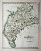
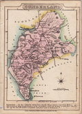
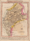
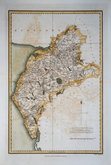
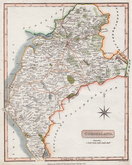
Cumberland Maps
( Page 3 of 6 )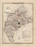
George Cole 1805
Henry Cooper 1808
John Cary 1808 [1809]
James Wallis 1812
James Wallis 1812 [1814]
Daniel & Samuel Lysons 1816
Samuel Neele 1819
Reuben Ramble 1819 [1845]


12x18 cm
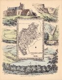
FROM THE "OWEN & BOWEN" POCKET ROAD BOOK BRITANNIA DEPICTA
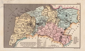
CUMBERLAND
Map set below a decorative cartouche containing the title and details of the road from Kendal to Cockermouth, &c..
Road map of the first part of the route from Kendal to Keswick verso.
Engraved text descriptions below the county map and alongside and below the road map verso.
Engraved by Emanuel Bowen (1693?-1767) and published in the pocket road book Britannia Depicta by Thomas Bowles from 1720 to 1764. The county maps were based on Robert Morden's small series published in The New Description and State of England... from 1701. Text descriptions compiled by John Owen.
Good example in fine hand colour both sides.
For full description of the road, go to category: Maps > British Isles > RoadMaps > Owen & Bowen
Quick Links


Northumberland Maps

Scotland Maps
×