
Northumberland Maps
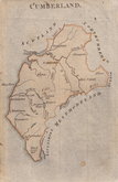
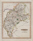
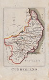
Cumberland Maps
( Page 2 of 6 )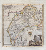
Thomas Kitchin 1750 [1786]
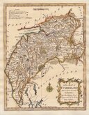
Thomas Kitchin 1763
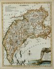
Joseph Ellis 1765 [1773]
John Cary 1787 [1793]
Joseph Johnson 1790
Benjamin Baker 1791
Robert Butters 1803
Jones & Smith 1804


35x45 cm
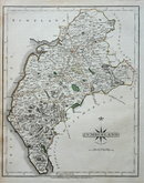
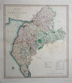
DUNCAN EDITION.
Map of the County of CUMBERLAND; Divided into Wards, Containing the District Divisions and other LOCAL ARRANGEMENTS effected by the REFORM BILL
London; Published by J. Duncan. Paternoster Row.
This series of county maps by William Ebden (fl.1811-1830) were first issued individually as loose sheet maps by various publishers from about 1811 but were not published in atlas form until issued by James Duncan, with all references to William Ebden removed and amendments, including the Reform Bill election details, in, A new atlas of England and Wales; consisting of a set of large county travelling maps . . . containing also the new district divisions . . . &c. agreeably to the provisions of the Reform Bill . . . London 1833. Duncan reissued his atlas several times until 1845 when the plates passed to H.G.Collins who published the maps by lithographic transfer until about 1870.
This example of the map of Cumberland is from a Duncan edition with Reform Bill and electoral information.
Some nicks to edges and short splits to centrefold not affecting the printed area. Some toning at centrefold.
Quick Links


Westmorland Maps

Scotland Maps
×