
Scotland Maps
Cumberland Maps
( Page 3 of 6 )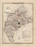
George Cole 1805
Henry Cooper 1808
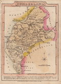
John Cary 1808 [1809]
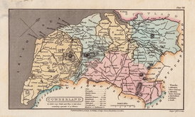
James Wallis 1812
James Wallis 1812 [1814]
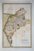
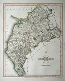
Daniel & Samuel Lysons 1816
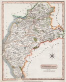
Samuel Neele 1819
Reuben Ramble 1819 [1845]


15x16 cm
ORIGINAL HAND COLOUR
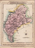
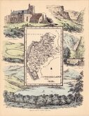
A Map of CUMBERLAND North from London.
Published in Chorographia Britanniae, from 1742 to 1749. The maps are engraved by William Henry Toms who claims to be the sole proprietor of the work. It is likely however, that Thomas Badeslade was an early partner responsible for the preparation of the maps, his name appearing on the first title page and on the imprints of the maps. since the maps are based on those of Herman Moll of 1724.The maps are based on those of Herman Moll of 1724 and if the claim on the title page that the maps were prepared for George I is to be believed, they were drawn between 1724 and 1727.
The first state of the maps appeared fairly plain with few place names marked but they were soon amended with the addition of more towns.
Good example in original hand colour from the third state of the plate with imprint dated 1742 published between 1742 and 1749.
Quick Links


Westmorland Maps

Northumberland Maps
×