
Scotland Maps
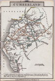
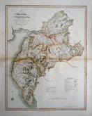
Cumberland Maps
( Page 4 of 6 )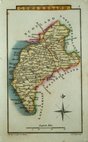
Sidney Hall 1820
W. H. Reid 1820
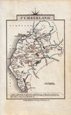
John Cary 1822
John Cary 1822
Roger Creighton 1831 [1842]
Joshua Archer 1833
William Ebden 1833
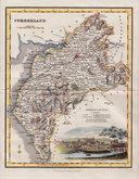
Robert Scott 1833 [1840]


18x11 cm
MINIATURE MAP IN ORIGINAL WASH COLOUR.
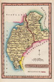
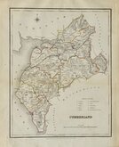
CUMBERLAND
Published Jany.1.1808, by R.Philips, Bridge Street, Blackfriars, London.
Cooper delt. et sculp.
Drawn and engraved by Henry Cooper, published by Richard Phillips in Benjamin Capper's Topographical Dictionary in 1808 and later issues of the same work by various publishers until 1839.
Henry Cooper (fl.1808-1819), was born about 1782, the son of Henry Cooper, a lighterman of Beer Lane, Tower Street, London. He was apprenticed to engraver John Warner (fl.1776-1811) from May 1787 and free Oct 1804. He was in partnership for a short time with hydrographer John Purdy (1773-1843) as map and chart sellers on Ludgate Hill, the partnership was dissolved Nov 1811 and bankruptcy proceedings commenced March 1812.
Good example in original wash hand colour from the first edition published by Richard Philips.
Quick Links


Westmorland Maps

Northumberland Maps
×