
Westmorland Maps
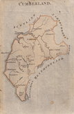
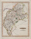
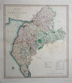
Cumberland Maps
( Page 2 of 6 )
Thomas Kitchin 1750 [1786]
Thomas Kitchin 1763
Joseph Ellis 1765 [1773]
John Cary 1787 [1793]
Joseph Johnson 1790
Benjamin Baker 1791
Robert Butters 1803
Jones & Smith 1804


10x15 cm
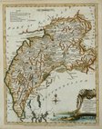
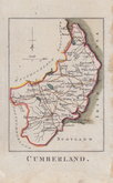
SIMPLE MAP SHOWING THE MAIN RIVERS.
CUMBERLAND.
Engraver unknown, this series of maps were first published in England delineated; or a geographical description of every county in England and Wales...(by John Aikin) London, J. Johnson 1788. There were five further issues of the work until 1809.
Some marks, including over title but still a good example in wash hand colour.
Quick Links


Scotland Maps

Northumberland Maps
×