
Westmorland Maps
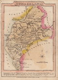
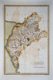
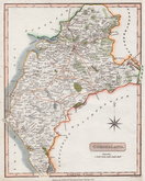
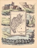
Cumberland Maps
( Page 3 of 6 )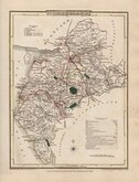
George Cole 1805
Henry Cooper 1808
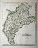
John Cary 1808 [1809]
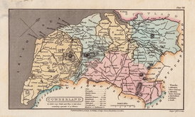
James Wallis 1812
James Wallis 1812 [1814]
Daniel & Samuel Lysons 1816
Samuel Neele 1819
Reuben Ramble 1819 [1845]


20x26 cm
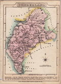
HIGHLY DECORATIVE VICTORIAN MAP
CUMBERLAND
This series of decorative steel-plate engraved maps are commonly known by the author of the work in which they first appeared; Moule's English Counties Delineated. First issued from May 1830 in a series of parts, the first complete edition was published by George Virtue in 1837. Several editions followed until 1839 and the plates were then used by George Virtue and his son James Sprent Virtue in A Complete and Universal Dictionary of the English Language by the Rev. James Barclay until 1857. The engraving of the plates was shared between James Bingley, William Schmollinger and John Dower. The plates underwent a number of changes, including the unexplained interchanging of engraver's names in the early issues, and were frequently updated to reflect the rapidly developing railway network.
William Francis Schmollinger (1811?-1869) was the engraver of this Cumberland map. Large vignette of Carlisle.Edition of 1845 with several railways added.
Very good clean condition with good margins in fine hand colour.
SPECIAL OFFER MOUNT AVAILABLE AT CHECKOUT FOR UK POSTAGE
Quick Links


Northumberland Maps

Scotland Maps
×