
Buckinghamshire Maps
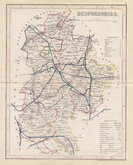
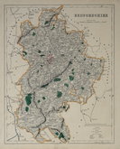
Bedfordshire Maps
( Page 4 of 4 )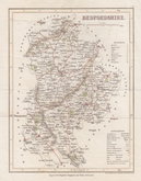
Joshua Archer 1842
Joshua Archer 1842 [1848]
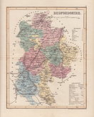
Joshua Archer 1842 [1860]
F. P. Becker & Co. 1845
Benjamin Rees Davies 1859 [1864]
Benjamin Rees Davies 1859 [1867]
Francis Sidney Weller 1894


16x23 cm
WOOD ENGRAVED MAP
No.XLV.] GUIDE TO KNOWLEDGE. PRICE ONE PENNY.
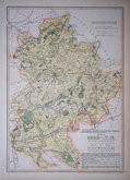
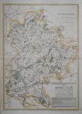
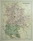
BEDFORDSHIRE
London, W Edwards, Ave Maria Lane.
J Archer sc. 100 Drummond Str. Euston Sq.
Woodblock engraved map by Joshua Archer. The woodblock was inked with a roller without working the ink into the engraved cuts thereby printing with a white line on a black ground. Published in parts by W. Edwards in The Guide to Knowledge edited by W Pinnock in 1833 (Bedforshire appearing 23rd March). The printing method was not popular for topographic maps and was not used again for English county maps. The woodblocks were later published by Thomas Johnson printed more conventionally by lithographic transfer in his rare publication Johnson's Atlas of England in 1847 & 1863.
Some fraying and nibbles to paper edges including some marginal repairs.
Betty Chambers Printed Maps of Bedfordshire Ref. 92 (i)
Quick Links

Bedfordshire Prints

Berkshire Maps
×