
Bedfordshire Prints
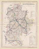
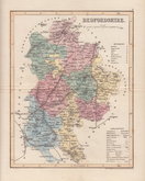
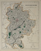
Bedfordshire Maps
( Page 4 of 4 )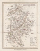
Joshua Archer 1842
Joshua Archer 1842 [1848]
Joshua Archer 1842 [1860]
F. P. Becker & Co. 1845
Benjamin Rees Davies 1859 [1864]
Benjamin Rees Davies 1859 [1867]
Francis Sidney Weller 1894


19x24 cm
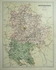
EARLY STEEL ENGRAVING WITH VIGNETTE OF ST. PAUL'S BRIDGE.
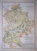
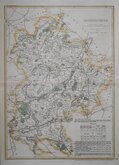
BEDFORDSHIRE
Engd. by Gray & Son
Pubd. by Archd. Fullarton & Co. Glasgow.
Steel engraving by Gray & Son first published in Bell's New and Comprehensive Gazetteer in 1833. The text for the gazetteer was largely copied from Lewis' Topographical Dictionary of 1831 and in 1839 Lewis obtained an injunction against Bell for plagiarism and the work was withdrawn. Archibald Fullarton, the publisher of Bell's Gazetteer republished the maps with new text in The Parliamentary Gazetteer from 1840 until 1849. Most of the maps were also copied from those in an earlier topographical dictionary, the maps by Sidney Hall prepared for John Gorton's Topographical Dictionary of Great Britain and Ireland published in 1831 as a rival to Lewis' work.
Good example of the map of Bedfordshire with vignette of Bedford bridge with St Pauls Church and part of the Town.
Betty Chambers Printed Maps of Bedfordshire Ref. 93 (I)
Quick Links

Buckinghamshire Maps

Berkshire Maps
×