
Berkshire Maps
Bedfordshire Maps
( Page 2 of 4 )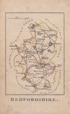
Robert Butters 1803
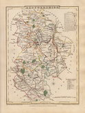
Cole & Roper 1804
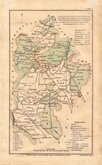
Henry Cooper 1808
John Cary 1809
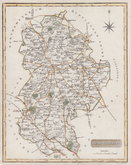
Samuel John Neele 1814
Sidney Hall 1820
John Cary 1824
Aristide Perrot 1824


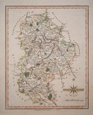
18x24 cm
FIRST EDITION ORIGINAL COLOUR.
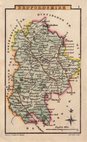
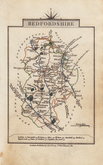
BEDFORDSHIRE
Drawn by R. Creighton | J. & C. Walker Sculp.t
Copper engraving by the firm of J & C Walker from a drawing by R. Creighton for publication in A Topographical dictionary of England… published by Samuel Lewis and Co. from 1831. The work achieved considerable success and was re-issued many times by Lewis until 1849. During this time the maps were amended and updated to include electoral information and the rapidly expanding railway network, with most counties known in at least six different states.
Good example from the first edition of 1831 in fine hand colour.
Betty Chambers Printed Maps of Bedfordshire Ref. 87 (i)
Quick Links


Buckinghamshire Maps
Bedfordshire Prints
×